Global position
Grenada in global perspective
Grenada lies in the south-eastern Caribbean Sea, at the southern end of the Lesser Antilles island arc and the southernmost of the Windward Islands. The State of Grenada comprises the island of Grenada together with Carriacou, Petite Martinique and several smaller islands of the southern Grenadines, with a combined land area of approximately 349 square kilometers.
The capital, St. George's, stands on the south-western coast at approximately 12°03′ N, 61°45′ W. Saint Vincent and the Grenadines lies to the north, Trinidad and Tobago to the south-east, and the coast of Venezuela approximately 160 kilometers to the south-west.
The islands sit on the boundary between the Caribbean Sea and the Atlantic Ocean, placing Grenada within the same maritime corridor as the established producing provinces of the southern Caribbean and the north-east coast of South America.
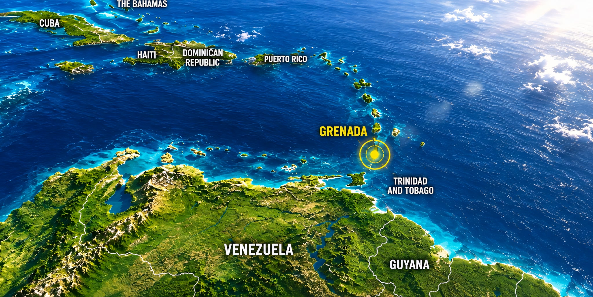
Map 1 — Grenada in the Caribbean | Click to view larger
Regional setting
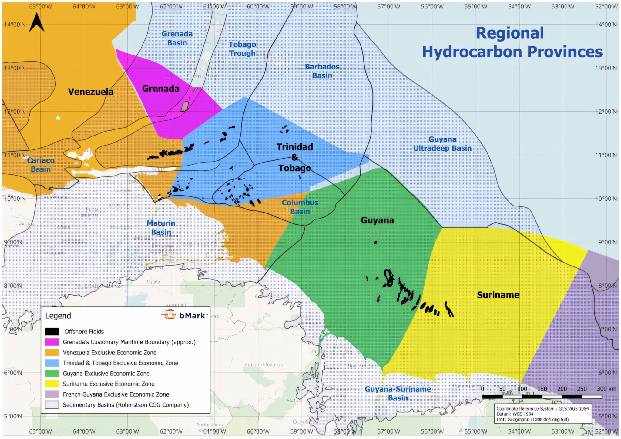
Map 2 — Regional hydrocarbon provinces | Click to view larger
Grenada in regional perspective
Grenada's offshore acreage lies where several of the southeast Caribbean region's hydrocarbon provinces meet. The Grenada Basin is located to the north-west of the island, the Tobago Trough and the Barbados Basin lie to the east southeast, and the southern margin adjoins the prolific North Coast Marine Area of Trinidad and Tobago and Venezuela along the Patao High with fields like Dragon and Mejillones in Venezuela.
Along the Atlantic margin, the Columbus Basin and the Guyana–Suriname Basin have oil and gas discoveries, with Guyana outpacing Trinidad and Tobago to become the largest oil producer in the region. Suriname has not yet started production but there have been promising discoveries. Grenada is located on that regional trend, adjacent to proven petroleum systems.
The island is within easy reach of North and South America and Europe and is in close proximity to established production bases and markets in Trinidad and Tobago.